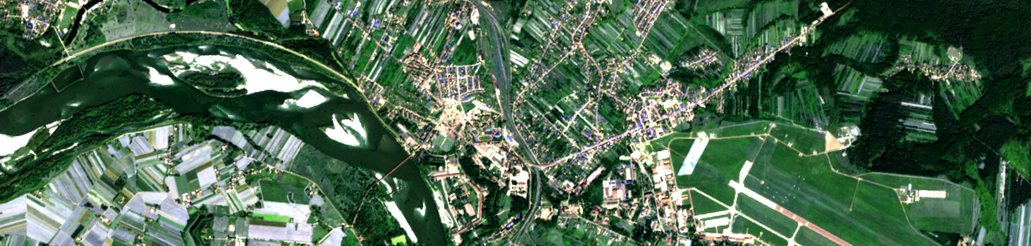


Klasy pokrycia terenu wyróżniane w programie CORINE Land Cover (CLC) są zorganizowane hierarchicznie w trzech poziomach.
Pierwszy poziom obejmuje pięć głównych typów pokrycia globu ziemskiego: tereny antropogeniczne, obszary rolnicze, lasy i ekosystemy seminaturalne, obszary podmokłe oraz obszary wodne. Na drugim poziomie zostało wyróżnionych 15 form pokrycia terenu, które można przedstawić na mapach w skalach od 1:500 000 do 1:1 000 000. Natomiast na poziomie trzecim wyróżniono 44 klasy. Ten poziom szczegółowości wydzieleń został zastosowany w opracowaniu baz danych pokrycia terenu we wszystkich krajach Europy.
Na potrzeby ulepszenia realizacji kolejnych baz danych Corine Land Cover (CLC) zaktualizowano niektóre definicje klas w oparciu o doświadczenia krajów wdrażających poszczególne edycje CLC.
Więcej informacji na temat klas pokrycia terenu znajduje się w zaktualizowanej w 2019 r. nomenklaturze "Updated CLC illustrated nomenclature Guidelines" link do publikacji/nomenklatury oraz w publikacji Instytutu Geodezji i Kartografii "Wytyczne nomenklatury Corine Land Cover. Poziom 3 (Międzynarodowy)”. Publikacja ta stanowi tłumaczenie dokumentu „Updated CLC illustrated nomenclature guidelines” (tłumaczenie zostało wykonane przez dr hab. Dariusza Dukaczewskiego, prof. IGiK, za zgodą Europejskiej Agencji Środowiska).
1. "Update CLC illustrated nomenclature guidelines", European Topic Centre on Urban, land and soil systems; ETC/ULS, European Environment Agency, 2019 r. link do publikacji
2. "Wytyczne nomenklatury Corine Land Cover. Poziom 3 (Międzynarodowy)", Instytut Geodezji i Kartografii, 2025 r. Pobierz publikację
Klasy pokrycia terenu Corine Land Cover
| Poziom 1 | Poziom 2 | Poziom 3 | |
| 1 - Tereny antropogeniczne | 1.1 - Zabudowa miejska | 1.1.1 |
Zabudowa miejska zwarta |
| 1.1.2 |
Zabudowa miejska luźna | ||
| 1.2 - Tereny przemysłowe, handlowe i komunikacyjne | 1.2.1 | Tereny przemysłowe i obiektów użyteczności publicznej | |
| 1.2.2 | Tereny sieci drogowej i kolejowej oraz z nimi związane | ||
| 1.2.3 | Tereny portów | ||
| 1.2.4 | Lotniska | ||
| 1.3 - Kopalnie, wyrobiska i budowy | 1.3.1 | Miejsca eksploatacji odkrywkowej | |
| 1.3.2 | Wysypiska, zwałowiska i hałdy | ||
| 1.3.3 | Budowy | ||
| 1.4 - Miejskie tereny zielone i wypoczynkowe | 1.4.1 | Miejskie tereny zielone | |
| 1.4.2 | Tereny sportowe i wypoczynkowe | ||
| 2 - Tereny rolne | 2.1 - Grunty orne | 2.1.1 | Grunty orne nie nawadniane |
| 2.1.2 | Grunty orne stale nawadniane | ||
| 2.1.3 | Pola ryżowe | ||
| 2.2 - Uprawy trwałe | 2.2.1 | Winnice | |
| 2.2.2 | Sady i plantacje | ||
| 2.2.3 | Gaje oliwne | ||
| 2.3 - Łąki i pastwiska | 2.3.1 | Łąki, pastwiska i inne tereny trawiaste w stałym użytkowaniu rolnym | |
| 2.4 - Obszary upraw mieszanych | 2.4.1 | Uprawy jednoroczne połączone z uprawami trwałymi | |
| 2.4.2 | Złożone systemy upraw i działek | ||
| 2.4.3 | Tereny zajęte głównie przez rolnictwo z dużym udziałem roślinności naturalnej | ||
| 2.4.4 | Tereny rolno-leśne | ||
| 3 - Lasy i ekosystemy seminaturalne | 3.1 - Lasy | 3.1.1 | Lasy liściaste |
| 3.1.2 | Lasy iglaste | ||
| 3.1.3 | Lasy mieszane | ||
| 3.2 - Zespoły roślinności drzewiastej i krzewiastej | 3.2.1 | Murawy i pastwiska naturalne | |
| 3.2.2 | Wrzosowiska i zakrzaczenia | ||
| 3.2.3 | Roślinność sucholubna (śródziemnomorska) | ||
| 3.2.4 | Lasy i roślinność krzewiasta w stanie zmian | ||
| 3.3 - Tereny otwarte, pozbawione roślinności lub z rzadkim pokryciem roślinnym | 3.3.1 | Plaże, wydmy, piaski | |
| 3.3.2 | Odsłonięte skały | ||
| 3.3.3 | Roślinność rozproszona | ||
| 3.3.4 | Pogorzeliska | ||
| 3.3.5 | Lodowce i wieczne śniegi | ||
| 4 - Obszary podmokłe | 4.1 - Śródlądowe obszary podmokłe | 4.1.1 | Bagna śródlądowe |
| 4.1.2 | Torfowiska | ||
| 4.2 - Przybrzeżne obszary podmokłe | 4.2.1 | Bagna słone (solniska) | |
| 4.2.2 | Saliny | ||
| 4.2.3 | Osuchy | ||
| 5 - Obszary wodne | 5.1 - Wody śródlądowe | 5.1.1 | Cieki |
| 5.1.2 | Zbiorniki wodne | ||
| 5.2 - Wody morskie | 5.2.1 | Laguny | |
| 5.2.2 | Estuaria | ||
| 5.2.3 | Morze i ocean | ||
Link do opisu klas Corine Land Cover (EN)
| Level 1 | Level 2 | Level 3 | |
| 1 - Artificial areas | 1.1 - Urban fabric | 1.1.1 |
Continuous urban fabric |
| 1.1.2 |
Discontinuous urban fabric | ||
| 1.2 - Industrial, commercial and transport units | 1.2.1 | Industrial or commercial units and public facilities | |
| 1.2.2 | Road and rail networks and associated land | ||
| 1.2.3 | Port areas | ||
| 1.2.4 | Airports | ||
| 1.3 - Mine, dump and construction sites | 1.3.1 | Mineral extraction sites | |
| 1.3.2 | Dump sites | ||
| 1.3.3 | Construction sites | ||
| 1.4 - Artificial non-agricultural vegetated areas | 1.4.1 | Green urban areas | |
| 1.4.2 | Sport and leisure facilities | ||
| 2 - Agricultural areas | 2.1 - Arable land | 2.1.1 | Non-irrigated arable land |
| 2.1.2 | Permanently irrigated arable land | ||
| 2.1.3 | Rice fields | ||
| 2.2 - Permanent crops | 2.2.1 | Vineyards | |
| 2.2.2 | Fruit tree and berry plantations | ||
| 2.2.3 | Olive groves | ||
| 2.3 - Pastures | 2.3.1 | Pastures, meadows and other permanent grasslands under agricultural use | |
| 2.4 - Heterogeneous agricultural areas | 2.4.1 | Annual crops associated with permanent crops | |
| 2.4.2 | Complex cultivation patterns | ||
| 2.4.3 | Land principally occupied by agriculture, with significant areas of natural vegetation | ||
| 2.4.4 | Agro-forestry areas | ||
| 3 - Forest and semi-natural areas | 3.1 - Forests | 3.1.1 | Broad-leaved forest |
| 3.1.2 | Coniferous forest | ||
| 3.1.3 | Mixed forest | ||
| 3.2 - Shrubs and/or herbaceous vegetation associations | 3.2.1 | Natural grassland | |
| 3.2.2 | Moors and heathland | ||
| 3.2.3 | Sclerophyllous vegetation | ||
| 3.2.4 | Transitional woodland/shrub | ||
| 3.3 - Open spaces with little or no vegetation | 3.3.1 | Beaches, dunes, and sand plains | |
| 3.3.2 | Bare rock | ||
| 3.3.3 | Sparsely vegetated areas | ||
| 3.3.4 | Burnt areas | ||
| 3.3.5 | Glaciers and perpetual snow | ||
| 4 - Wetlands | 4.1 - Inland wetlands | 4.1.1 | Inland marshes |
| 4.1.2 | Peatbogs | ||
| 4.2 - Coastal wetlands | 4.2.1 | Coastal salt marshes | |
| 4.2.2 | Salines | ||
| 4.2.3 | Intertidal flats | ||
| 5 - Water bodies | 5.1 - Inland waters | 5.1.1 | Water courses |
| 5.1.2 | Water bodies | ||
| 5.2 - Marine waters | 5.2.1 | Coastal lagoons | |
| 5.2.2 | Estuaries | ||
| 5.2.3 | Sea and ocean | ||