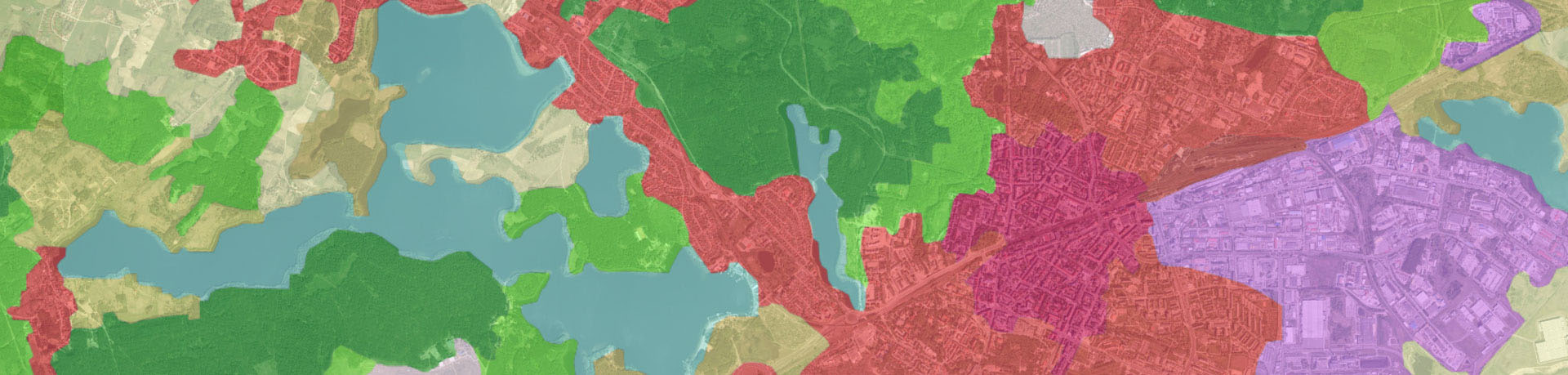
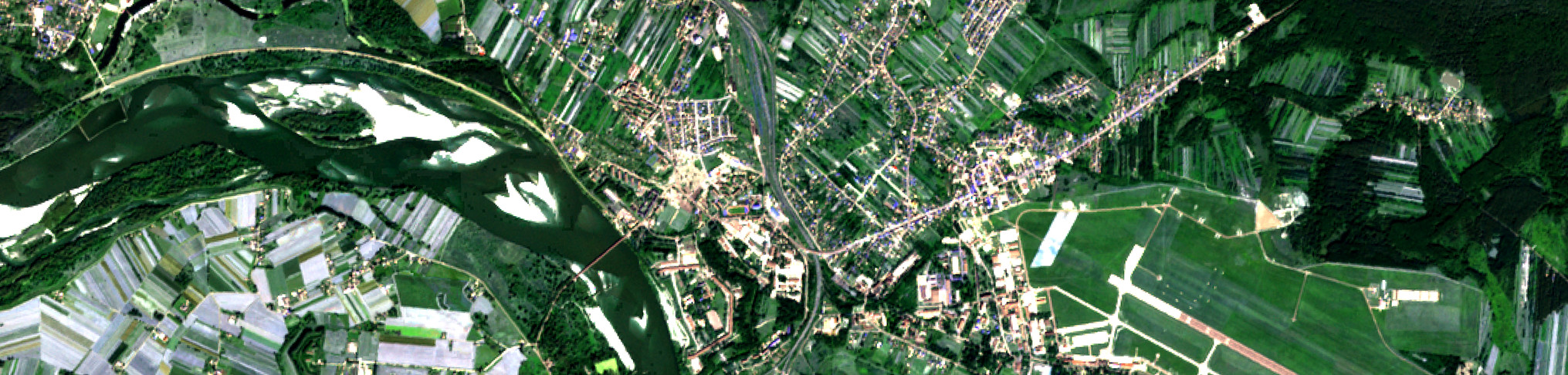


LEGENDA klas pokrycia terenu Corine Land Cover
Link do opisu klas Corine Land Cover (EN)
| Level 1 | Level 2 | Level 3 | |
| 1 - Artificial areas | 1.1 - Urban fabric | 1.1.1 |
Continuous urban fabric |
| 1.1.2 |
Discontinuous urban fabric | ||
| 1.2 - Industrial, commercial and transport units | 1.2.1 | Industrial or commercial units and public facilities | |
| 1.2.2 | Road and rail networks and associated land | ||
| 1.2.3 | Port areas | ||
| 1.2.4 | Airports | ||
| 1.3 - Mine, dump and construction sites | 1.3.1 | Mineral extraction sites | |
| 1.3.2 | Dump sites | ||
| 1.3.3 | Construction sites | ||
| 1.4 - Artificial non-agricultural vegetated areas | 1.4.1 | Green urban areas | |
| 1.4.2 | Sport and leisure facilities | ||
| 2 - Agricultural areas | 2.1 - Arable land | 2.1.1 | Non-irrigated arable land |
| 2.1.2 | Permanently irrigated arable land | ||
| 2.1.3 | Rice fields | ||
| 2.2 - Permanent crops | 2.2.1 | Vineyards | |
| 2.2.2 | Fruit tree and berry plantations | ||
| 2.2.3 | Olive groves | ||
| 2.3 - Pastures | 2.3.1 | Pastures, meadows and other permanent grasslands under agricultural use | |
| 2.4 - Heterogeneous agricultural areas | 2.4.1 | Annual crops associated with permanent crops | |
| 2.4.2 | Complex cultivation patterns | ||
| 2.4.3 | Land principally occupied by agriculture, with significant areas of natural vegetation | ||
| 2.4.4 | Agro-forestry areas | ||
| 3 - Forest and semi-natural areas | 3.1 - Forests | 3.1.1 | Broad-leaved forest |
| 3.1.2 | Coniferous forest | ||
| 3.1.3 | Mixed forest | ||
| 3.2 - Shrubs and/or herbaceous vegetation associations | 3.2.1 | Natural grassland | |
| 3.2.2 | Moors and heathland | ||
| 3.2.3 | Sclerophyllous vegetation | ||
| 3.2.4 | Transitional woodland/shrub | ||
| 3.3 - Open spaces with little or no vegetation | 3.3.1 | Beaches, dunes, and sand plains | |
| 3.3.2 | Bare rock | ||
| 3.3.3 | Sparsely vegetated areas | ||
| 3.3.4 | Burnt areas | ||
| 3.3.5 | Glaciers and perpetual snow | ||
| 4 - Wetlands | 4.1 - Inland wetlands | 4.1.1 | Inland marshes |
| 4.1.2 | Peatbogs | ||
| 4.2 - Coastal wetlands | 4.2.1 | Coastal salt marshes | |
| 4.2.2 | Salines | ||
| 4.2.3 | Intertidal flats | ||
| 5 - Water bodies | 5.1 - Inland waters | 5.1.1 | Water courses |
| 5.1.2 | Water bodies | ||
| 5.2 - Marine waters | 5.2.1 | Coastal lagoons | |
| 5.2.2 | Estuaries | ||
| 5.2.3 | Sea and ocean | ||
Więcej informacji na temat klas pokrycia terenu znajduje się w zaktualizowanej w 2019 r. nomenklaturze "Updated CLC illustrated nomenclature Guidelines” link do nomenklatury CLC oraz w publikacji Instytutu Geodezji i Kartografii "Wytyczne nomenklatury Corine Land Cover. Poziom 3 (Międzynarodowy)”, 2025 r. Pobierz publikację
Klasy pokrycia terenu Corine Land Cover (PL), tłumaczenie klas według ww. publikacji IGiK z 2025 r.
| Poziom 1 | Poziom 2 | Poziom 3 | |
| 1 - Tereny antropogeniczne | 1.1 - Zabudowa miejska | 1.1.1 |
Zabudowa miejska zwarta |
| 1.1.2 |
Zabudowa miejska luźna | ||
| 1.2 - Tereny przemysłowe, handlowe i komunikacyjne | 1.2.1 | Tereny przemysłowe i obiektów użyteczności publicznej | |
| 1.2.2 | Tereny sieci drogowej i kolejowej oraz z nimi związane | ||
| 1.2.3 | Tereny portów | ||
| 1.2.4 | Lotniska | ||
| 1.3 - Kopalnie, wyrobiska i budowy | 1.3.1 | Miejsca eksploatacji odkrywkowej | |
| 1.3.2 | Wysypiska, zwałowiska i hałdy | ||
| 1.3.3 | Budowy | ||
| 1.4 - Miejskie tereny zielone i wypoczynkowe | 1.4.1 | Miejskie tereny zielone | |
| 1.4.2 | Tereny sportowe i wypoczynkowe | ||
| 2 - Tereny rolne | 2.1 - Grunty orne | 2.1.1 | Grunty orne nie nawadniane |
| 2.1.2 | Grunty orne stale nawadniane | ||
| 2.1.3 | Pola ryżowe | ||
| 2.2 - Uprawy trwałe | 2.2.1 | Winnice | |
| 2.2.2 | Sady i plantacje | ||
| 2.2.3 | Gaje oliwne | ||
| 2.3 - Łąki i pastwiska | 2.3.1 | Łąki, pastwiska i inne tereny trawiaste w stałym użytkowaniu rolnym | |
| 2.4 - Obszary upraw mieszanych | 2.4.1 | Uprawy jednoroczne połączone z uprawami trwałymi | |
| 2.4.2 | Złożone systemy upraw i działek | ||
| 2.4.3 | Tereny zajęte głównie przez rolnictwo z dużym udziałem roślinności naturalnej | ||
| 2.4.4 | Tereny rolno-leśne | ||
| 3 - Lasy i ekosystemy seminaturalne | 3.1 - Lasy | 3.1.1 | Lasy liściaste |
| 3.1.2 | Lasy iglaste | ||
| 3.1.3 | Lasy mieszane | ||
| 3.2 - Zespoły roślinności drzewiastej i krzewiastej | 3.2.1 | Murawy i pastwiska naturalne | |
| 3.2.2 | Wrzosowiska i zakrzaczenia | ||
| 3.2.3 | Roślinność sucholubna (śródziemnomorska) | ||
| 3.2.4 | Lasy i roślinność krzewiasta w stanie zmian | ||
| 3.3 - Tereny otwarte, pozbawione roślinności lub z rzadkim pokryciem roślinnym | 3.3.1 | Plaże, wydmy, piaski | |
| 3.3.2 | Odsłonięte skały | ||
| 3.3.3 | Roślinność rozproszona | ||
| 3.3.4 | Pogorzeliska | ||
| 3.3.5 | Lodowce i wieczne śniegi | ||
| 4 - Obszary podmokłe | 4.1 - Śródlądowe obszary podmokłe | 4.1.1 | Bagna śródlądowe |
| 4.1.2 | Torfowiska | ||
| 4.2 - Przybrzeżne obszary podmokłe | 4.2.1 | Bagna słone (solniska) | |
| 4.2.2 | Saliny | ||
| 4.2.3 | Osuchy | ||
| 5 - Obszary wodne | 5.1 - Wody śródlądowe | 5.1.1 | Cieki |
| 5.1.2 | Zbiorniki wodne | ||
| 5.2 - Wody morskie | 5.2.1 | Laguny | |
| 5.2.2 | Estuaria | ||
| 5.2.3 | Morze i ocean | ||