


In 2005–2006, strategic discussions amongst member countries, the European Parliament and the main EU institutions responsible for environmental policy, reporting and assessment (DG ENV, EEA, ESTAT and JRC) have underlined an increasing need for factual and quantitative information on the state of the environment to be based on timely, quality assured data, in particular in land cover and land use related issues. To monitor the land cover dynamics properly there was a need to shorten the CLC updating period from ten to five-six years.
EEA and EC in collaboration with the European Space Agency (ESA) decided to conduct updating of CLC database for a reference year 2006 within Fast Track service – GMES Land Monitoring. CLC 2006 was a continuation of previous CLC 1990 and CLC 2000 projects. A novelty of CLC 2006 project is that all changes > 5 ha have to be mapped, not only those that are associated to existing polygons. The CLC 2006 database will be generated in a, mostly, automatic way with some human interaction by combining CLC 2000 and the photointerpreted CLC-Changes.
As the Landsat-7 satellite, used in CLC 2000, was not available (technical fault of sensor), new sources of suitable satellite imagery had to be found for the purposes of CLC 2006 project. As a result of collaboration with ESA to implement GMES services, two satellites provide the necessary imagery for CLC 2006 project:SPOT-4 and IRS P6. IMAGE2006 project aims to provide a multitemporal satellite data coverage (two dates) for the area to be mapped in order to achieve high quality photointerpretation.
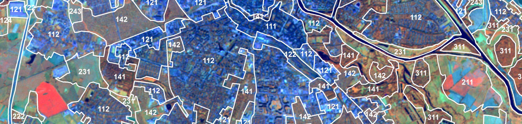
In Poland, about 0.5% of the country was subject to land cover changes during the period 2000-2006. The changes occurred mainly within forest areas, where forest management (clear-cutting) was done or natural disasters (wind-breaks) appeared. These changes reached approximately 60 % of the total observed changes. The second type of changes is related to agricultural areas – 30 % of total changes. Changes of urban/artificial areas reached 8 %. The remaining land cover categories did not reveal significant changes over the analyzed period. CLC2006 was co-financed by EEA and participating country.
Results of CLC 2006 project at national level:
- CORINE Land Cover 2006 for Poland - land cover/land use database – (CLC2006_PL) in e00 and .shp formats
- CORINE Land Cover 2000-2006 for Poland - land cover/land use changes database – (CHA_PL) in e00 and .shp formats
- Corrected CORINE Land Cover 2000 for Poland - land cover/land use database – (CLC00_PL) in e00 and .shp formats
- Metadata for Poland (Metadata for CORINE 2000-2006 database, metadata for CORINE Land Cover 2006 database – files in .doc format (MC00_PL, MC0CH_PL)
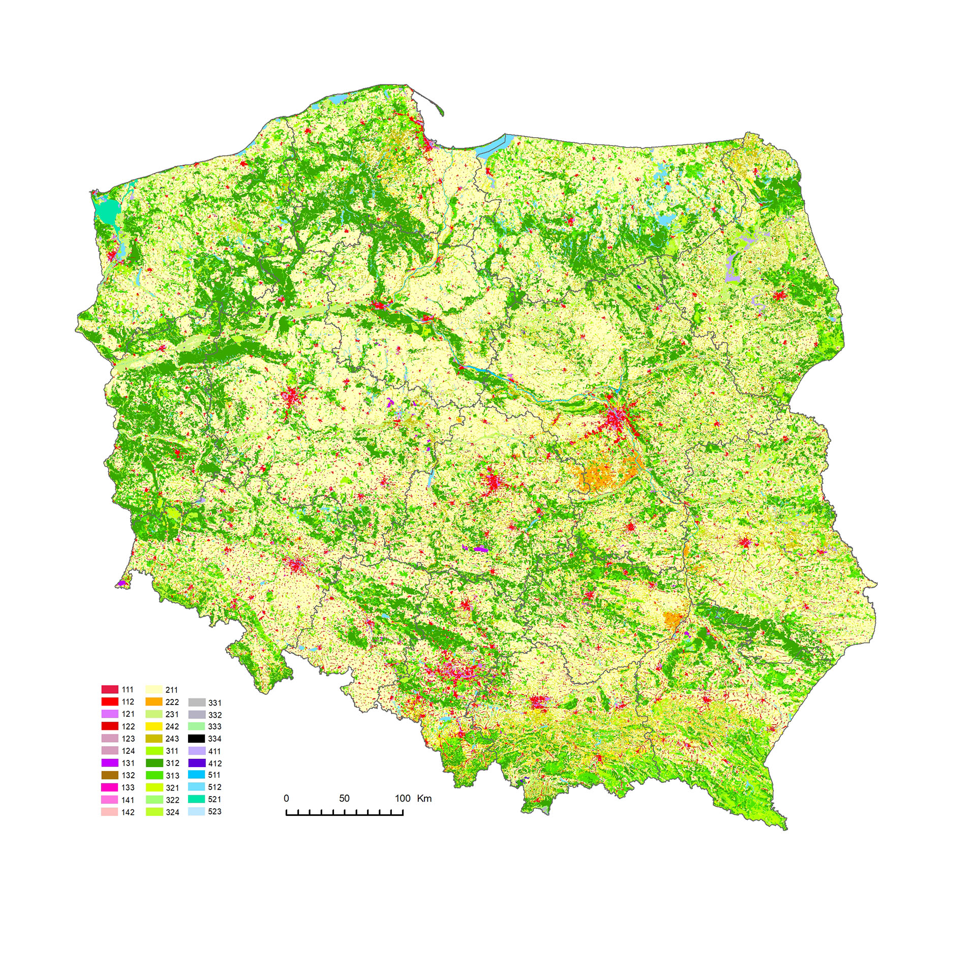
Map CLC 2006
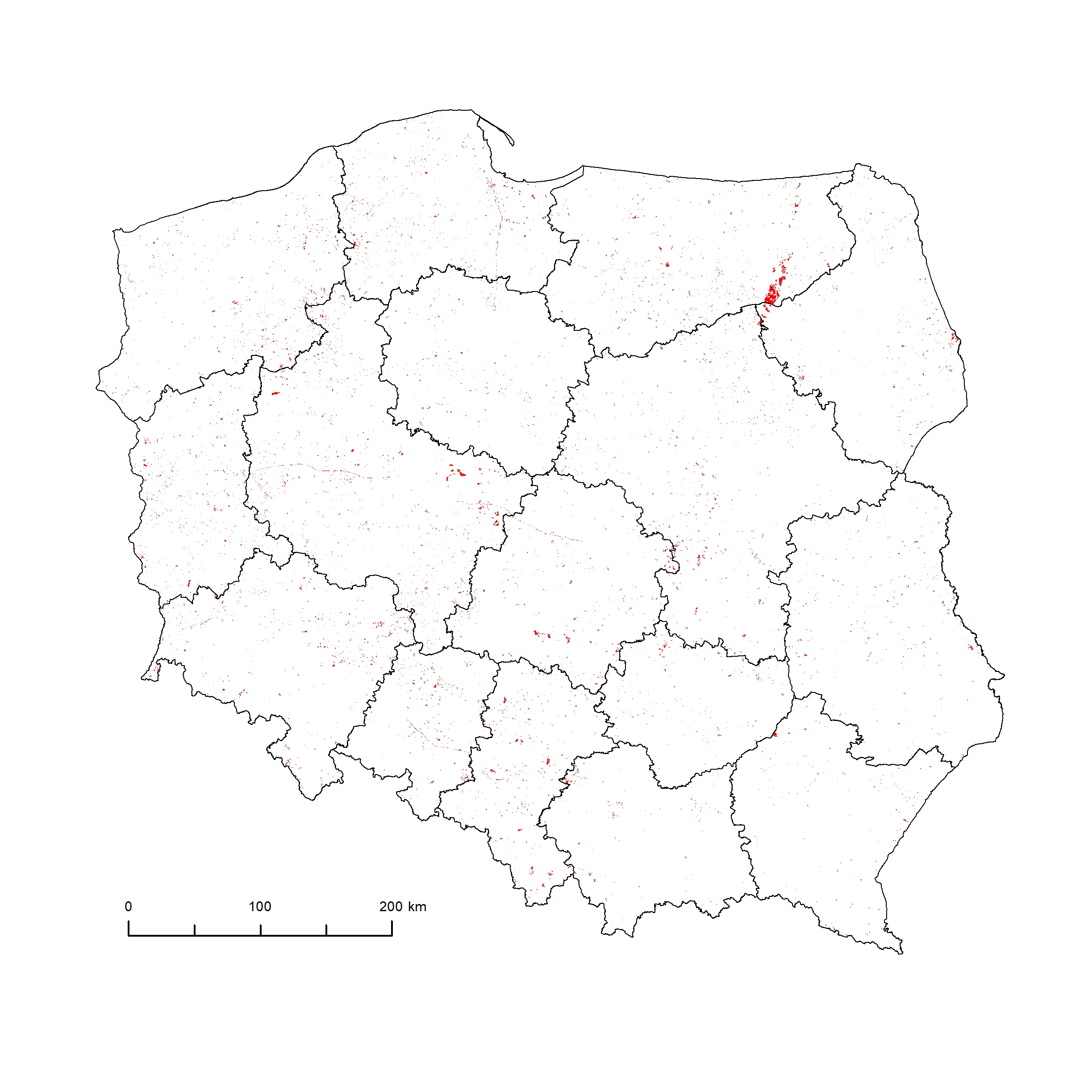
Attachments: CLC-Changes 2000-2006
Reference system:
Land cover/land use information was presented in the coordinate system PL_EUREF89 / 1992 (EUREF-POL) characterized by the following parameters:
- Ellipsoid: GRS80
- Longer axis of ellipsoid: 6378137
- Projection: Transverse Mercator
- Units: meters
- Central meridian: 19,00000
- Coordinates of origin: X=500 000, Y=-5 300 000
- Change of scale at central meridian: 0,9993